Table of Contents
|
Editorial
|
2
|
Scientific and Professional Papers
|
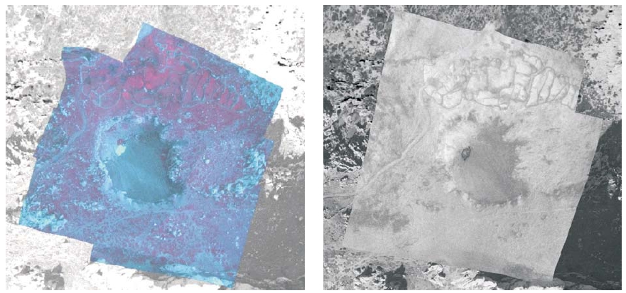
Andrija Krtalić
|
4-11
|
|
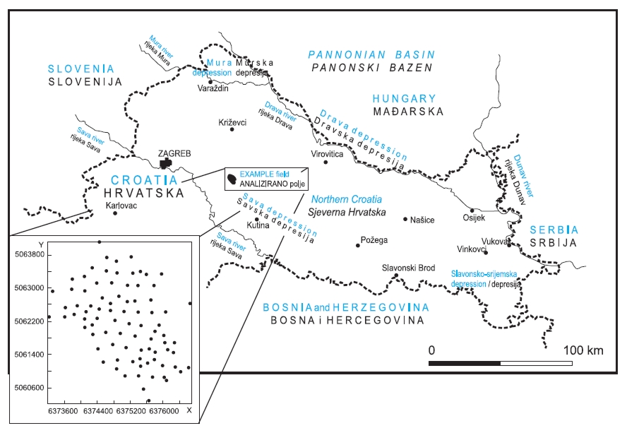
Production of a Porosity Map by Kriging in Sandstone Reservoirs, Case Study from the Sava Depression
Tomislav Malvić
|
12-19
|
|
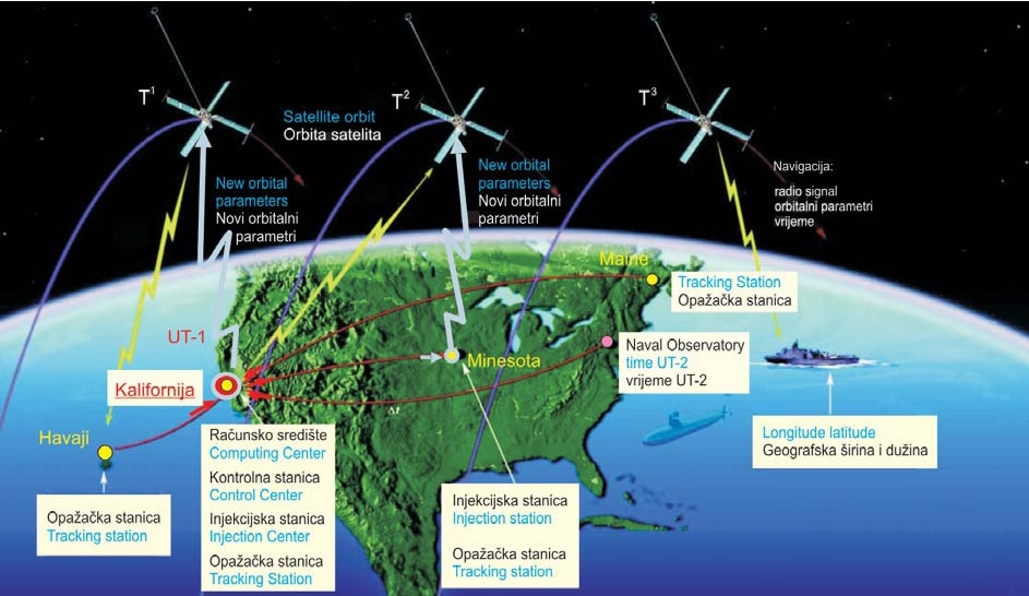
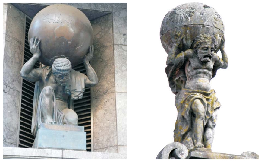
Miljenko Solarić
|
20-40
|
|
Miljenko Lapaine, Olga Perić, Ivo Dubravčić
|
42-53
|
Doctors and Masters of Sciences
|
Vlado Cetl, PhD in Technical Sciences
Miodrag Roić
|
54-57
|
|
Ksenija Pešun, Master in Geodesy
Miodrag Roić
|
58-61
|
|
Danijel Šugar, MSc in Technical Sciences, Scientific Field Geodesy
Mario Brkić
|
60-63
|
Software Reviews
|
Bibliographia Cartographica on the Internet
Nedjeljko Frančula
|
65
|
|
Hrčak - Portal of Croatian Scientific Journals
Nedjeljko Frančula, Robert Župan
|
66-67
|
Book, Journal and Other Publication Reviews
|
Nataša Bajić-Žarko: Archive of Maps for Istria and Dalmatia, Cadastre of Dalmatia 1823-1975, Inventory
Ivka Kljajić
|
68-71
|
|
Miroslav Rožman i Ljerka Šimunković: Imperial Surveyor and Lexicographer Agrimensore imperiale e lessicografo Antonio Putti
Ivka Kljajić, Miljenko Lapaine
|
70-73
|
|
Benedikt Kotruljević (Benedetto Cotrugli): De Navigatione/About Navigation
Vanja Miljković, Miljenko Lapaine
|
74-77
|
|
Milko Brković, Ivana Ćubela, Suzana Martinović: Dalmatian Zagora on Venetian Cadastres from 17th and 18th Century in the State Archive in Zadar
Vanja Miljković
|
78-79
|
|
Lexicon of Technique
Stanislav Frangeš
|
80-81
|
Conferences and Exhibitions
|
Island of Rava Scientific Conference, Zadar - Rava, June 20-23, 2008
Ana Kuveždić, Miljenko Lapaine
|
82-85
|
|
2nd International Conference on Cartography and GIS, Borovets, January 21-24, 2008
Miljenko Lapaine
|
86-89
|
Curiosities
|
Megamap of the Dubrovnik and Neretva County - The Largest Printed Map in the World
Ivan Landek, Igor Vilus, Ivan Grubić
|
90-95
|
|
Geodetic Surveying and Mountaineering
Margareta Premužić, Berto Slevka
|
96-101
|
From Professional Societies
|
Sixth Annual Assembly of the Croatian Cartographic Society
Vesna Poslončes-Petrić
|
102-103
|