Beginnings of Satellite Navigation
Abstract
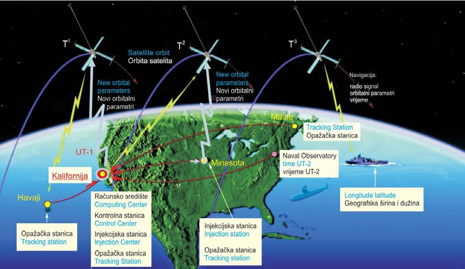
The first satellite navigation system called the Navy Navigation Satellite System (NNSS) or TRANSIT was planned in the USA in 1958. It consisted of 5-6 artificial Earth satellites, was set in motion for the USA military in 1964, and in 1967 for civilian purposes. The frequency shift of received radio waves emitted from the satellite and caused by the Doppler effect was measured. The TRANSIT satellite speed of approaching or moving away was derived from that; the TRANSIT satellites emmited also their own coordinates. Then the ship's position was determined by an intersection of three hyperboloids, which were determined from differences of distances in three time intervals. Maintenance of this navigation system was stopped in 1996, but it is still being used in the USA Navy for exploring the ionosphere. Furthermore, results of Doppler measurements in international projects at the Hvar Observatory from 1982 and 1983. This was the first time in Croatia and the former country that the coordinates of the Hvar Observatory were determined in the unique world coordinate system WGS'72. The paper ends with a brief representation of the Tsiklon Doppler navigation system produced in the former Soviet Union, and there is a list of some of numerous produced and designed satellite navigation systems.
Ključne riječi
Keywords
navigation; satellites; radio wave; broadcast ephemeris; precise ephemeris; Doppler shift of frequencies; determination position of ship; Navy Navigational Satellite System (NNSS)
Copyright (c) 2008 Miljenko Solarić

This work is licensed under a Creative Commons Attribution-ShareAlike 4.0 International License.