
Original Scientific Paper
Ethnic Maps as a Politically Sensitive Issue: Methodological Aspects and Practice
https://doi.org/10.32909/kg.21.si.5
Abstract
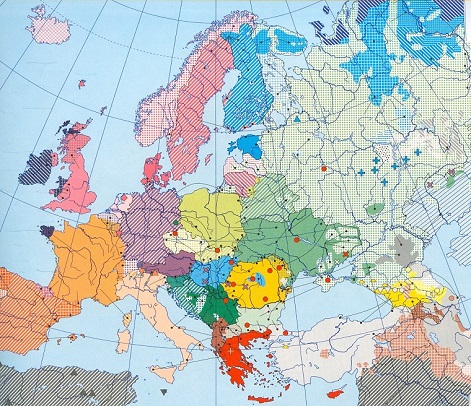
Ethnic maps have regained importance and are again frequently published, due to an increase in ethnic consciousness, many ethnic conflicts and the attempts of young states particularly in eastern Europe to present themselves as nation states by ethnic maps. Questions of their methodology, of how suitable individual ethno-cartographic methods are to depict certain ethnic structures and whether they are applied correctly or not are therefore on the agenda of cartography as a formal science. This paper investigates the suitability of the main ethno-cartographic methods (areal method, dot spread method, diagram method) to render certain ethnic structures.
Keywords
ethnic cartography; nations; ethnic groups; cartographic methodology; Central and Southeast Europe
Copyright (c) 2023 Peter Jordan

This work is licensed under a Creative Commons Attribution-ShareAlike 4.0 International License.