
Review article
Real Environment 3D Model – a Base for 3D Map Making
https://doi.org/10.32909/kg.21.si.2
Abstract
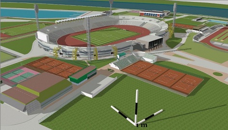
3D maps are one of the most attractive cartographical products for map users. They can present the real environment in a photorealistic, readable way, keeping enough geo-spatial information for the needs of different users. Very often users don’t make a difference between 3D maps and 3D models of the real environment. The aim of this report is to clarify when we can speak of 3D maps and even to discuss the definition of a 3D map.
The article considers the cartographical elements applied in 3D mapping which help a 3D model to become a 3D map: user requirements, map contents, symbol system, accuracy, scale, projections and generalization, levels of details. The new cartographical elements are added to improve 3D maps: virtual camera, shades, lights, animation. In conclusion, the author will explain when we can speak of a 3D model and when of a 3D map.
The article considers the cartographical elements applied in 3D mapping which help a 3D model to become a 3D map: user requirements, map contents, symbol system, accuracy, scale, projections and generalization, levels of details. The new cartographical elements are added to improve 3D maps: virtual camera, shades, lights, animation. In conclusion, the author will explain when we can speak of a 3D model and when of a 3D map.
Keywords
3D model; 3D map; 3D symbols; 3D mapping; Cartography
Copyright (c) 2023 Temenoujka Bandrova

This work is licensed under a Creative Commons Attribution-ShareAlike 4.0 International License.