A Method of Cartographic Visualization for Climate Change Maps
Abstract
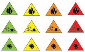
Maps are essential in climate change research. This paper considers examples of cartographic visualizations for different climate change characteristics. International map symbol systems used in climate change maps are analyzed. The aim of the paper is to demonstrate the need for a single symbol system for these maps. It is suggested that thematic elements in the contents of climate change maps be introduced. The need for a single, clear, consistent approach to designing symbols for presenting climate change theme is presented. The basic cartographic rules for the application of graphic variables are considered.
Keywords
Climate change maps; climate change consequences; cartographic visualization
Copyright (c) 2012 Nadka Stoimenova

This work is licensed under a Creative Commons Attribution-ShareAlike 4.0 International License.