The French Scientific Surveying Expedition to Peru
Abstract
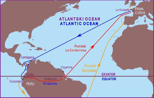
The paper describes how the lengths of parts of the meridian arc were measured in Peru (modern-day Ecuador). The field teams encountered great difficulties, due to the climate conditions in which they had to work, and the configuration of the terrain. However, they succeeded in measuring extremely accurately the length of the meridian arc corresponding to the range of latitude 3°07'01'', and were thus able to conclude that the length of one degree of the meridian arc in Peru was equivalent to 56 749 toises (110 604 m). They also established that the shape of the Earth took the approximate form of a rotational ellipsoid, thus confirming the theoretical postulations of Newton and Huygens.
Keywords
trigonometric chain, base length, astronomical measurement, latitudinal difference, sextant, quadrant, length of one degree of the meridian arc, Peru, rotational ellipsoid
Copyright (c) 2014 Miljenko Solarić, Nikola Solarić

This work is licensed under a Creative Commons Attribution-ShareAlike 4.0 International License.