Optimal Conformal Polynomial Projections for Croatia According to the Airy/Jordan Criterion
Abstract
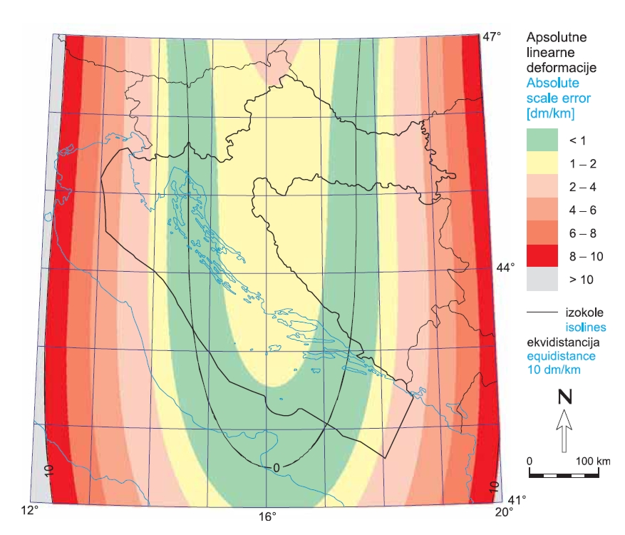
The paper describes optimal conformal polynomial projections for Croatia according to the Airy/Jordan criterion. A brief introduction of history and theory of conformal mapping is followed by descriptions of conformal polynomial projections and their current application. The paper considers polynomials of degrees 1 to 10. Since there are conditions in which the 1st degree polynomial becomes the famous Mercator projection, it was not considered specifically for Croatian territory. The area of Croatia was defined as a union of national territory and the continental shelf. Area definition data were taken from the Euro Global Map 1:1 000 000 for Croatia, as well as from two maritime delimitation treaties. Such an irregular area was approximated with a regular grid consisting of 11 934 ellipsoidal trapezoids 2' large. The Airy/Jordan criterion for the optimal projection is defined as minimum of weighted mean of Airy/Jordan measure of distortion in points. The value of the Airy/Jordan criterion is calculated from all 11 934 centres of ellipsoidal trapezoids, while the weights are equal to areas of corresponding ellipsoidal trapezoids. The minimum is obtained by Nelder and Mead’s method, as implemented in the fminsearch function of the MATLAB package. Maps of Croatia representing the distribution of distortions are given for polynomial degrees 2 to 6 and 10. Increasing the polynomial degree results in better projections considering the criterion, and the 6th degree polynomial provides a good ratio of formula complexity and criterion value.
Keywords
conformal polynomial projections; Croatia; Airy/Jordan criterion
Copyright (c) 2013 Dražen Tutić

This work is licensed under a Creative Commons Attribution-ShareAlike 4.0 International License.