
Original Scientific Paper
Visual Images on Medieval and Early Modern World Maps: Iconography of the Known and the Unknown
https://doi.org/10.32909/kg.21.38.2
Abstract
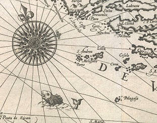
This interdisciplinary research is focused on visual images on maps of the known world spanning from the medieval to the early modern period. Regardless of their purpose, which could range from ideological representations of the medieval world, as were O or T maps, to practical sailing maps like portolan charts and other early modern nautical charts of the (already known) world in a smaller scale, they carried the standard scope of geo-cartographic data and content. Besides, they offered a rich illustrative component of respectable graphic quality. This depended on the purpose of the map, as well as the geographical knowledge of its author on one hand and on the skill and expertise of its creator on the other. Through this short synchronic and diachronic overview of the iconographic elements of Old World maps, especially in respect to Croatian lands, some chronological continuities of cartographic presentation were revealed. The spread of ideas and ideologies communicated and disseminated by these will also be discussed.
Keywords
World Maps; Middle Ages; Early Modern Period; Visual Art; Iconography; Imagology
Copyright (c) 2023 Palmira Krleža, Dubravka Mlinarić

This work is licensed under a Creative Commons Attribution-ShareAlike 4.0 International License.