Fire and Explosion Risk Assessment for the Republic of Croatia
https://doi.org/10.32909/kg.18.31.3
Abstract
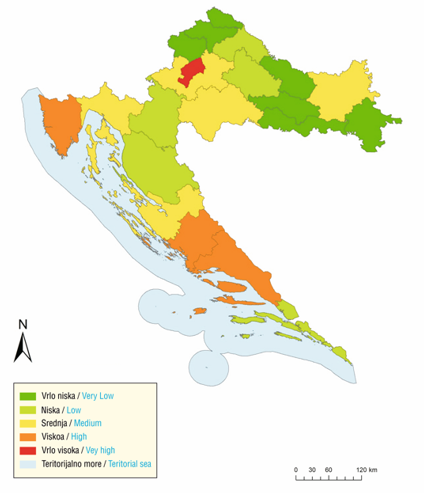
Through a spatial and statistical analysis, the paper aims to assess vulnerability based on the service capabilities of public fire brigades in the Republic of Croatia. An assessment of fire hazard impacts was developed based on historical fire data over a twenty-year period for the counties and City of Zagreb, an assessment of exposure based on critical infrastructure data for the counties and City of Zagreb, and an assessment of resilience based on the coverage zones of fire brigades within the standard intervention time (15 min) for the counties and City of Zagreb. The results of the research have various potential applications and can be used as a basis for the future planning and development of the fire protection system to serve and protect people, material and cultural goods.
Keywords
Republic of Croatia, risk assessment; fires; GIS analysis; geography of hazards
Copyright (c) 2019 Juraj Ban, Željko Sutlar, Andrija Antolović

This work is licensed under a Creative Commons Attribution-ShareAlike 4.0 International License.