The Croatian Mile on Old Maps
Abstract
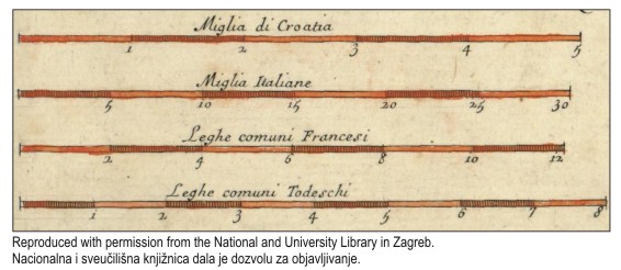
Stjepan Glavač’s map of 1673 is a valuable and unique example of Croatian cartographic heritage. The map was the first to show a graphic scale in the Croatian miles. Many authors mentioned the Croatian mile, but did not agree on its length. In addition to a copy of Glavač’s map, copies of Janez Vajkard Valvasor’s map of 1689, Giacomo Cantelli da Vignola’s map of 1690, Antun Belavić’s map of 1739 and the map Kraljevinâ Dalmacije, Hrvatske i Slavonije ... of 1746 were obtained and studied for the purpose of this paper. The Croatian mile was drawn on these maps in addition to other types of mile. The ratios of the Croatian mile to the German, Italian and French miles were calculated with the help of these maps. An overview of the ratios of the Croatian mile to other miles is provided. The Croatian mile is defined as one-tenth of the length of one degree of the Equator. The length of the Croatian mile, for the radius of the Earth R = 6371 kilometres, is 11 120 metres or approximately eleven kilometres.
Keywords
Copyright (c) 2016 Marina Viličić, Miljenko Lapaine

This work is licensed under a Creative Commons Attribution-ShareAlike 4.0 International License.
