Croatia and Europe: A Journey through Historical Maps
Abstract
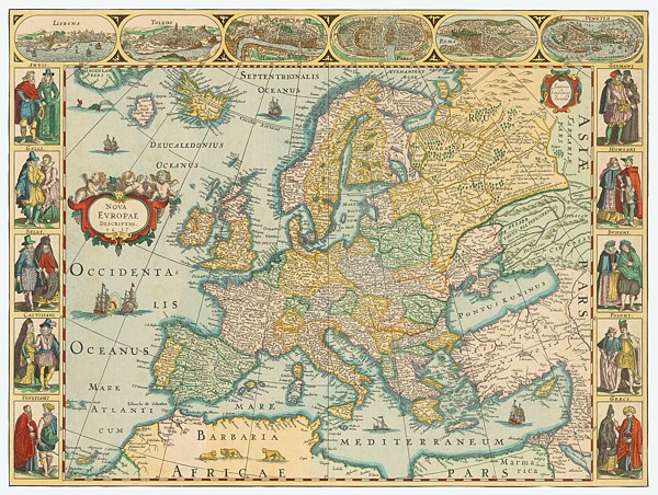
Museums, galleries, archives and other cultural institutions were invited to organize open days and invite citizens, visitors and tourists to visit them by the Ministry of Culture of the Republic of Croatia on the occasion of Croatia becoming a member of the European Union. The suggestion was to enable free access to existing or special programs, cultural events and celebrations. The Croatian State Archives responded and organized the exhibition Croatia and Europe: A Journey through Historical Maps, which could be seen in the atrium of the Croatian State Archives (CSA) from July 1 to 31, 2013. The exhibition featured the most valuable and attractive maps preserved in the Map Collection of CSA, which encompassed the period from the middle of the 16th century to the beginning of the 20th century.
The goal of the exhibition was to present manuscript and printed maps, as well as thematic map facsimiles by various cartographers, whose maps represented Europe and Croatia more or less accurately, with regard to existing cartographic knowledge, knowledge of represented areas, maps’ purpose and circumstances they were produced in. There were charts, general and historical maps of Europe and Croatian lands, as well as demarcation maps through various periods. A total of 36 manu-script and copper-engraved maps were exhibited.
Copyright (c) 2014 Mirjana Jurić

This work is licensed under a Creative Commons Attribution-ShareAlike 4.0 International License.