Proposal for a New Model for Highway Records in the Republic of Croatia
Abstract
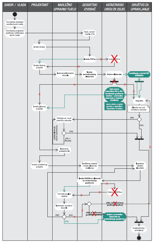
Highways are public roads, whose function is to integrate Croatia in the European transport system, link the regions of Croatia and facilitate transit traffic. They are public property for general use, owned by the Republic of Croatia, and they cannot be the subject of acquisition or other proprietary rights of any kind. Today, there are two types of highway record-keeping. The first is conducted by leading companies authorised to manage highways in order to develop a highway database, or create a highway register. The second is conducted by land-management systems; the Cadastre and Land Registry. They are the official public registers for keeping records of land plots, buildings and other structures, and their ownership. Procedures that need to be implemented in the second type of record-keeping often get "stuck" in practice. Based on the problems identified in this model and an analysis of the state of record-keeping, a proposal for a new model for highway records in the Cadastre and Land Registry is given.
Keywords: highways; building plot; expropriation; record; Cadastre; Land Registry
Copyright (c) 2013 Rinaldo Paar, Zdravko Kapović, Ante Marendić

This work is licensed under a Creative Commons Attribution-ShareAlike 4.0 International License.