GIS of the Crikvenica –"Igralište" Archaeological Site
Abstract
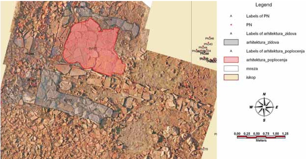
In the last few years, archaeological excavations have been carried out in Crikvenica. Remains of ceramic kilns, walls and a large amount of residual ceramics were found at the site, by the auxiliary soccer field. These findings confirmed the assumptions of the existence of a large manufacture. Furthermore, it is also assumed that the Roman settlement Ad Turres, which is marked on the famous Tabula Peutingeriana was precisely at this location. The paper describes in detail the GIS of the archaeological site. First, the required data were collected. While the archaeologists were excavating (attribute data), the authors were surveying the field. Tacheometric and photogrammetric method (positional data) were applied in order to survey details. Data for about 400 archaeological findings can be found in the GIS database. There is a presentation of possibilities of analyzing special findings (artefacts) according to height and type.
Keywords
archaeology, GIS, Crikvenica, Ad turres
Copyright (c) 2008 Iva Malarić, Mateo Gašparović

This work is licensed under a Creative Commons Attribution-ShareAlike 4.0 International License.