Cartographical Documents in the Heritage of Ivan Lončarić Papić
Abstract
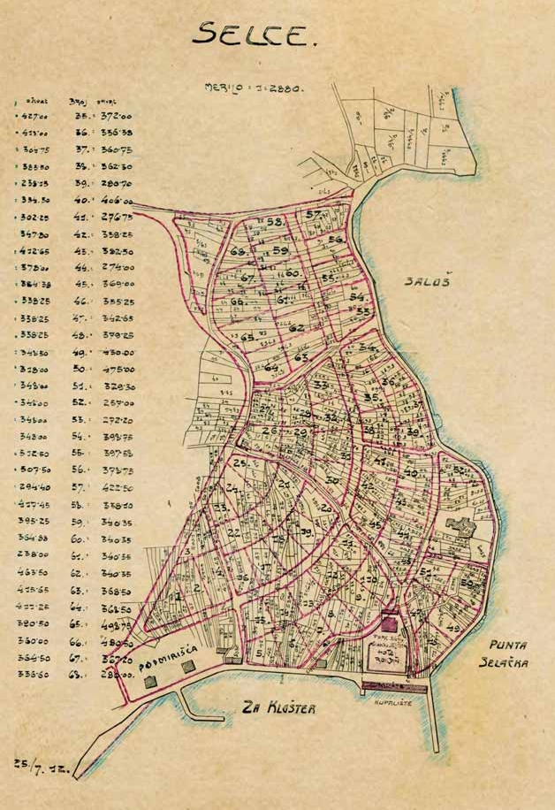
A total of 13 cartographical documents were found in the heritage of Ivan Lončarić Papić which is kept at the People's Library and Reading Room in Selce and this paper is the first presentation of these documents in literature. The documents are mainly thematic maps and plans Papić collected during the first half of the 20th century. A part of them is a data source for the history of Selce in the first half of the 20th century. This paper represents only the first step in detailed processing of the cartographic material that can be found within Papić's heritage.
Keywords
Ivan Lončarić Papić; Selce; cartographic documents; plans; charts
Copyright (c) 2008 Robert Lončarić

This work is licensed under a Creative Commons Attribution-ShareAlike 4.0 International License.