Letters of Chartered Land Surveyors at the State Archive in Zadar
Abstract
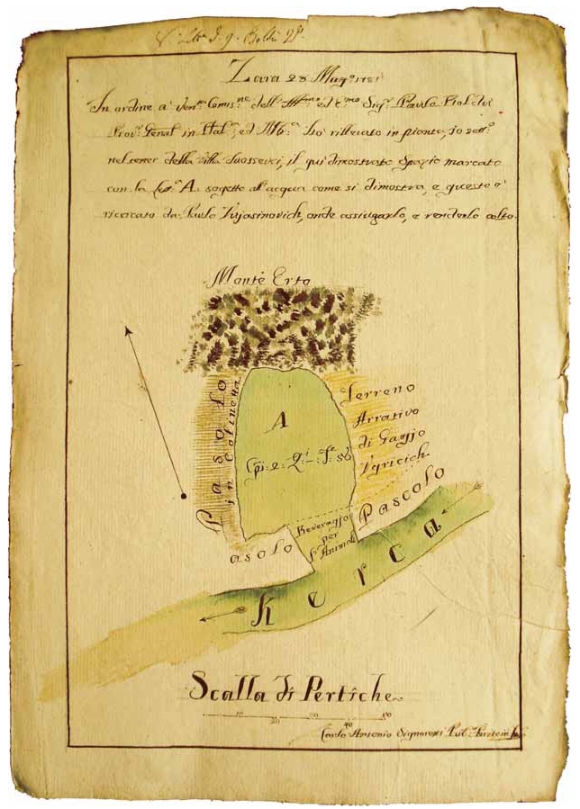
The purpose of this paper is to present and analyze a small part of geodetic and cartographic heritage from the period of Venetian administration in Dalmatia which has been kept and preserved at the State Archive in Zadar. Due to the establishment of cadastral service for the purposes of Venetian administration, land surveyors worked in the field. The subject of this research are letters from the State Archive in Zadar, written by land surveyors in field and addressed to General Regent. The research contains 674 letters dealing with the issue of cadastral survey throughout the 18th century. Importance and complexity of these letters rest upon the fact that surveys refer mostly to the border area between Venetian and Turkish properties in Dalmatia, an area where the border was often submitted to changes. Every new acquisition of the Venetian administration brought inevitable changes to the land area. Since some of the letters contain maps of specific areas, they also represent a valuable contribution to cartography.
Keywords
land surveyor; State Archive in Zadar; cadastre; cartography; letter
Copyright (c) 2008 Lena Mirošević, Miljenko Lapaine

This work is licensed under a Creative Commons Attribution-ShareAlike 4.0 International License.