Split-Dalmatia County Map

Comparison of Two Maps of the Split-Dalmatia County

Stanislav Frangeš

Abstract


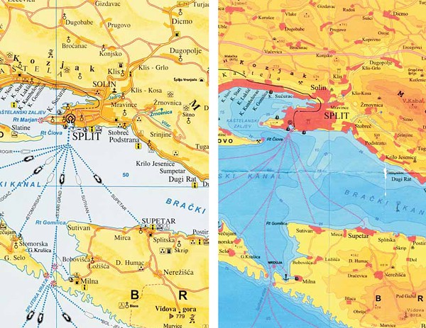
Tourist map – Central Dalmatia – Split-Dalmatia County and Regional map Central Dalmatia, Split and surroundings – School map – Split-Dalmatia County

Some time ago, I stumbled upon two different maps of the Split-Dalmatia County. At first, I noticed how different they were concerning colours, data amount and representation, as well as arrangement of outer lettering elements. I was surprised even more when I read that both maps were produced by the same authors. This motivated me to analyse the maps in more detail and present the results of their comparison.


Full Text:

PDF PDF (Hrvatski)


Copyright (c) 2013 Stanislav Frangeš

Creative Commons License
This work is licensed under a Creative Commons Attribution-ShareAlike 4.0 International License.


The Kartografija i Geoinformacije (Cartography and Geoinformation) journal publishes scientific and professional papers from cartography and other fields (geography, geodesy, geology, forestry, agronomy, history, architecture, pedagogy ...) if they are related to cartography and geoinformation.
We invite authors of papers or contributions to submit text in English (and Croatian if possible) using this site.

The Croatian Cartographic Society (CCS) does not necessarily endorse any opinions or recommendations made in article, review or extract contained in this journal nor do they necessarily represent CCS policy.
© CCS, www.kartografija.hr. Journal content is published under CC BY-SA licence.