
Evaluation of Tourist Activities and Destination Attraction Capacity Using Geotags
https://doi.org/10.32909/kg.18.32.3
Abstract
Tourist location data accessible through social networks is a new source of information which is opening up great opportunities for studying tourism activities. We used tourist geotags from the VKontakte social network to evaluate the attractiveness of tourist destinations around the Caucasian Mineral Waters. Based on the data received from the public profiles of tourists publishing geotags, we analyzed their gender- and age-related structure, seasonal preferences, and geographic origins. The resort of Pyatigorsk was used as a case study to develop a classification of recreational areas for local people and tourists.
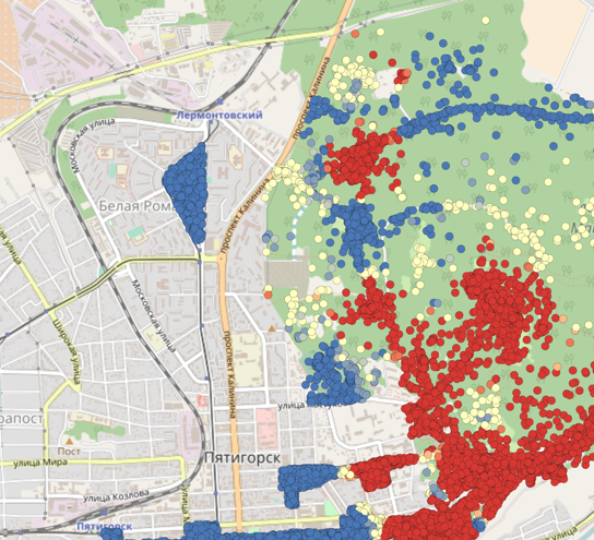
Women prevailed among those displaying their photos – 64.7%. The two major seasons for attaching photos were spring and summer – 64.8 % of the photos. The specific feature of the Caucasian Mineral Waters viewed as a tourist destination implied the prevalence of intraregional geotags over interregional ones. The major interregional tourist flow came from the cities of Moscow, St. Petersburg, Rostov-on-Don, and Krasnodar. The geotags on photos, therefore, may be used as an alternative source of information when evaluating the tourist activity and attractiveness of these destinations.
Women prevailed among those displaying their photos – 64.7%. The two major seasons for attaching photos were spring and summer – 64.8 % of the photos. The specific feature of the Caucasian Mineral Waters viewed as a tourist destination implied the prevalence of intraregional geotags over interregional ones. The major interregional tourist flow came from the cities of Moscow, St. Petersburg, Rostov-on-Don, and Krasnodar. The geotags on photos, therefore, may be used as an alternative source of information when evaluating the tourist activity and attractiveness of these destinations.
Keywords
geotagged photos; geographic information analysis; tourism activities; tourist destination; attraction capacity
Copyright (c) 2019 Vladimir Sergeevich Tikunov, Vitalii Semenovich Belozerov, Stanislav Olegovich Antipov

This work is licensed under a Creative Commons Attribution-ShareAlike 4.0 International License.