The Story of Syrian Refugee Crisis Across Europe Through the Lens of Cartography
Abstract
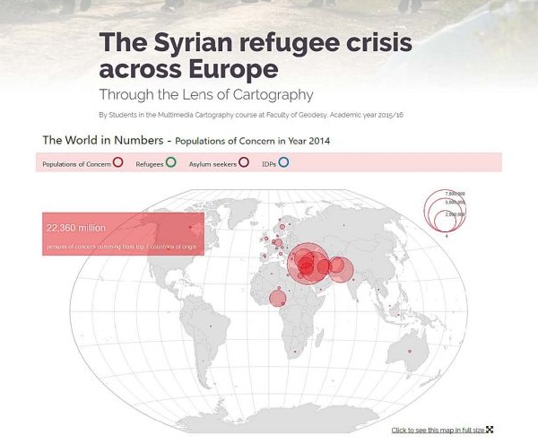
By Students in the Multimedia Cartography course at Faculty of Geodesy, University of Zagreb in Academic year 2015/16
A compelling multimedia narrative story of the Syrian refugee crisis across Europe (www.geof.unizg.hr/~akuvezdic/MultimediaCartography-Course2016.html) was envisioned by a group of graduate students enrolled in Multimedia Cartography, a course offered through the Faculty of Geodesy at University of Zagreb (eucenje.geof.unizg.hr). This multimedia visualization was created as an assignment for the course exercises during the summer 2016 academic term, in which students had to choose arbitrarily a subject to be visualized in a multimedia environment to explore the effects and components of a multimedia map.
Keywords
map, refugee crises, Europe
Copyright (c) 2016 Ana Kuveždić Divjak

This work is licensed under a Creative Commons Attribution-ShareAlike 4.0 International License.