Vindšachta Water Reservoir – Using GIS Tools for a Comparison of Storage Capacity in 1887 and 2014
Abstract
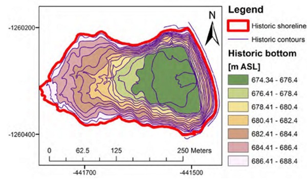
This article focuses on an analysis of the storage capacity of Vindšachta water reservoir in Štiavnické Bane, Banská Štiavnica district, at two points in time: 1 887 (old) and 201 4 (current). The analysis was performed using an old bathymetry map dated 1 887 and current data from sonar surveying (201 4). The analysis was performed by comparing water volumes calculated from digital elevation models of the reservoir bottom for each year, using an area-storage capacity curve. During the period between the two years, the water volume decreased to 85% of the initial storage capacity (from 335 000 m3 to 285 000m3).
Keywords
water volume change, GIS, sonar surveying, old maps
Copyright (c) 2015 Jakub Fuska, Daniel Kubinský, Lenka Lackóová, Karol Weis

This work is licensed under a Creative Commons Attribution-ShareAlike 4.0 International License.