Geospatial Intelligence: A Review of the Discipline in the Global and Croatian Contexts
Abstract
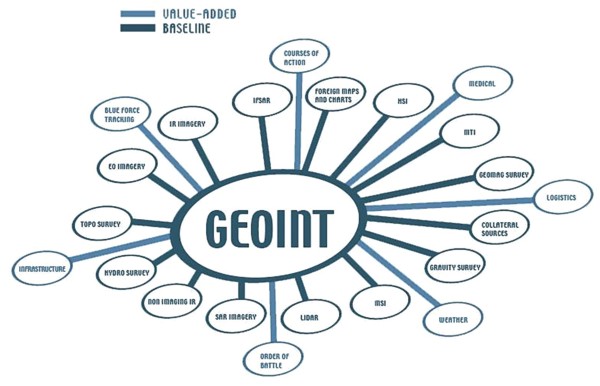
Geospatial intelligence is a new direction in the development of geographic information science. Besides being a scientific discipline, it is also an intelligence activity and technology directed towards ensuring support for decision-making processes. It complements conventional GIS by combining data from various sources and creating an interactive environment that involves simultaneous access and input to integrated information by a group of individuals with different areas of expertise. The most prominent fields of application in geospatial intelligence are military operations and disaster management. The discipline is currently in the early stage of development in Croatia, and is almost entirely associated with Croatian participation in the Multinational Geospatial Co-production Program.
Keywords
geospatial intelligence, GEOINT, geospatial information, GIS
Copyright (c) 2015 Neven Tandarić

This work is licensed under a Creative Commons Attribution-ShareAlike 4.0 International License.