Determining Appropriate Seasonal Dislocation Sites of Fire Brigades in the Šibenik-Knin County Based on Road Network Analysis
Abstract
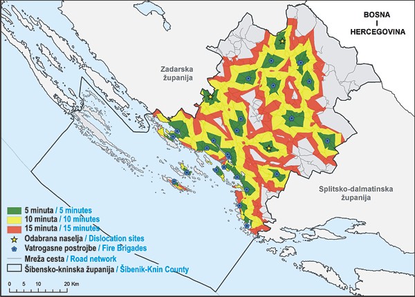
The majority of wildfires in the Republic of Croatia occur in coastal and island areas, so the Šibenik-Knin County was studied in this research. This research was based upon spatial and temporal analyses of past fires in the Šibenik-Knin County using GIS tools in order to identify potential locations for seasonal dislocation of fire stations. The research resulted in cartographic visualization of areas within reach of existing fire brigades within the standard intervention time and potential locations for seasonal dislocation of fire stations. The results obtained using spatial GIS analysis can be used as a basis for future spatial planning and seasonal dislocation of fire stations in the Šibenik-Knin County, as well as a basis for determining dislocation of fire stations in other Croatian counties.
Keywords
Šibenik-Knin County, GIS analysis, wildfires, fire station dislocation
Copyright (c) 2015 Doroteja Držaić, Mateja Kavran, Andrija Antolović

This work is licensed under a Creative Commons Attribution-ShareAlike 4.0 International License.