Quality Assessment and Comparison of Global Digital Elevation Models on the Territory of Republic of Croatia
Abstract
Users of digital elevation models must be aware of their main characteristics in order to judge better their suitability for a specific application. In this study, a comparison and evaluation of the characteristics of seven publicly available global digital elevation models were made for territory of the Republic of Croatia. The models chosen were: ASTER, SRTM, SRTM30+, ACE2, GMTED2010, GTOPO30 and ETOPO1. For each digital elevation model, the most important characteristics are given: construction methods, resolution, horizontal and vertical datum, and estimated accuracy.
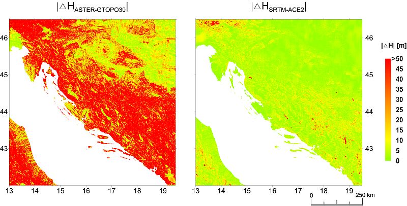
In addition, in relation to Croatia as a whole, differences between digital elevation models at identical points were determined and analysed, after the models had been adjusted to the same resolution. The model differences yielded information on the mutual correspondence between the models and areas of disagreement, and allowed an evaluation of the presence of major, systematic errors indicating the existence of significant differences between the various global elevation models. The causes of differences between digital models are numerous, and users need to recognize the relevance of errors to the final results of a particular scientific or expert task.
Keywords
Copyright (c) 2014 Matej Varga, Tomislav Bašić

This work is licensed under a Creative Commons Attribution-ShareAlike 4.0 International License.