Contribution to Research with Regard to the Activities of Ruđer Josip Bošković as a Surveyor and Cartographer
Abstract
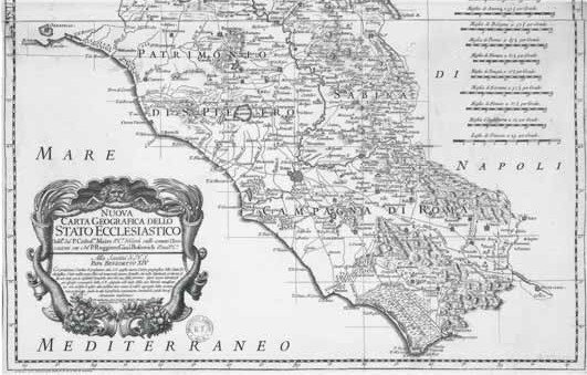
This paper presents an overview of the work of Ruđer Josip Bošković, emphasising his activities as a cartographer and surveyor. Bošković made a great contribution to the geodesy and surveying of his time through innovations which he initially used to achieve better accuracy of measurement. He concluded that existing maps did not meet the needs of professional and expert use. As a result of his surveying and travels, he made a Map of the Ecclesiastical State, often appending his opinions and criticisms of other experts.
Keywords: Ruđer Bošković, geodesy, cartography, map, Ecclesiastical State
Copyright (c) 2013 Robert Župan, Stanislav Frangeš, Vesna Poslončec-Petrić

This work is licensed under a Creative Commons Attribution-ShareAlike 4.0 International License.