Improvement of National Spatial Data Infrastructure as a Public Project of Permanent Character
Abstract
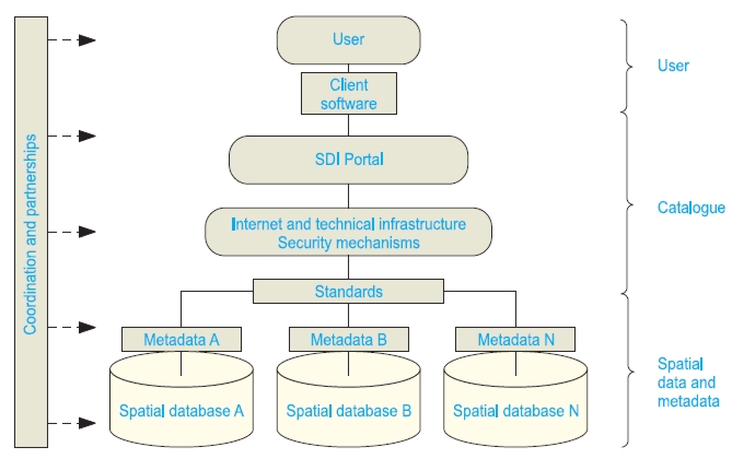
Establishing a spatial data infrastructure means improving the existing one and can be defined as a number of activities aiming at easier access to and wider dissemination of the existing spatial data, and easier and more efficient use of them. Considering importance and benefits of the spatial data infrastructure for the whole society, the improvement should be seen as a public project of permanent character. This paper gives a theoretical overview of planning and implementation of such project, as a possible model of improving the existing national spatial data infrastructure in Croatia.
Keywords
national spatial data infrastructure; improvement; project management; Croatia
Copyright (c) 2013 Vlado Cetl, Siniša Mastelić Ivić, Hrvoje Tomić

This work is licensed under a Creative Commons Attribution-ShareAlike 4.0 International License.