
Original Scientific Paper
The Island of Korčula on Early Modern Maps
https://doi.org/10.32909/kg.21.si.8
Abstract
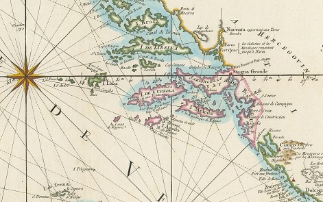
Based on selected cartographic depictions of Korčula from the early modern age, the paper examines the geographical knowledge about that island at the time the maps were made. Special attention is directed to the hitherto unknown map of the island of Korčula from the second half of the 16th or the first half of the 17th century, which is kept in the Archivio do Stato di Venezia, given that it shows a very detailed escription of the island of Korčula, especially its western part. The objective of this paper, using the example of the island of Korčula, is to point out the importance of cartographic renderings as an important source of spatial data and to determine whether there was a gradual improvement in the quality of the displayed geographical content in accordance with the assumed development of geographical knowledge and cartographic techniques from the beginning of the 16th century to the end of the 18th century. On the basis of the selected cartographic depictions of the island of Korčula, the significance of the island of Korčula in maritime and geographic frameworks characterized by different political interests, primarily that of Venice, was confirmed. The diachronic series of early modern geographical maps and nautical charts points to the gradual development of geographical knowledge about the island of Korčula, as well as to the improvement of the quality of graphical visualization of the relevant spatial data about that Croatian island.
Keywords
old maps; geographical names; island of Korčula; Dalmatia; Croatia
Copyright (c) 2023 Lena Mirošević, Josip Faričić

This work is licensed under a Creative Commons Attribution-ShareAlike 4.0 International License.