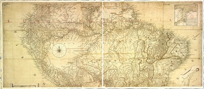
Map Projection Analysis of the Nova Lusitania Map
https://doi.org/10.32909/kg.20.35.3
Abstract
The map named Carta Geographica de Projecçaõ Espherica Orthogonal da Nova Lusitania ou America Portugueza e Estado do Brazil from 1798, together with its 1795 (?), 1797 and 1803 versions, is undoubtedly one of the cartographic monuments developed by Portuguese cartography from the late eighteenth century. Its organizer was the geographer, astronomer, and frigate captain Antonio Pires da Silva Pontes Leme, who relied on the work of 34 people, including astronomers, geographers, and engineers, who, although only mentioned in the 1798 version, contributed to the creation of all versions.
All of them are similar in appearance, but differ in size, content, details, amount, and distribution of toponyms, which will be the subject of another paper. The greatest similarity, however, concerns the defined map projection.
The objective of this paper is to analyse and present the possible hypotheses and conclusions about which map projection was adopted for all versions of Nova Lusitania, through the identification of characteristics that allowed to infer and prove the adopted projection.
The applied methodology verified that in the bibliographic search, the information about the map structure is insufficient. An article presented by General Djalma Polli Coelho in October 1950 states that the projection suggested by its title, as orthogonal spherical, appeared to be the Sanson-Flamsteed equal-area projection. However, the expression Carta Geographica de Projecçaõ Espherica Orthogonal allows us to infer also the transverse orthographic projection.
Through parameters defined for the two projections, it was possible to establish the comparative elements for a cartographic analysis, which would allow us to conclude and prove the structure adopted for the map, allowing to conclude if the adopted projection for the Nova Lusitania was an azimuthal orthographic equatorial projection, or a Sanson-Flamsteed, sinusoidal projection on the meridian 315°, defined west-east, (counterclockwise), from the El Hierro (Ferro) Island. This meridian is referenced approx. –62°39'46" off the Greenwich meridian.
Keywords
Copyright (c) 2021 Paulo Márcio Leal de Menezes, Kairo da Silva Santos, Tainá Laeta, Francisco José Corrêa Martins, Manoel do Couto Fernandes, José Gomes dos Santos, Miljenko Lapaine

This work is licensed under a Creative Commons Attribution-ShareAlike 4.0 International License.

