
Geoinformation Generalization by Aggregation
Abstract
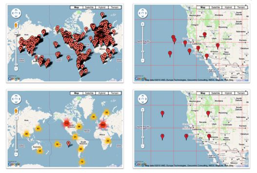
Geoinformation generalization can be divided into model generalization and cartographic generalization. Model generalization is the supervised reduction of data in a model, while cartographic generalization is the reduction of the complexity of map content adapted to the map scale, and/or use by various generalization operators (procedures). The topic of this paper is the aggregation of geoinformation. Generally, aggregation is the joining of nearby, congenial objects, when the distance between them is smaller than the minimum sizes. Most researchers in geoinformation generalization have focused on line features. However, the appearance of web-maps with point features and choropleth maps has led to the development of concepts and algorithms for the generalization of point and polygonal features. This paper considers some previous theoretical premises and actual examples of aggregation for point, line and polygonal features. The algorithms for aggregation implemented in commercial and free GIS software were tested. In the conclusion, unresolved challenges that occur in dynamic cartographic visualizations and cases of unusual geometrical features are highlighted.
Keywords
Copyright (c) 2016 Tomislav Jogun, Nada Vučetić, Dražen Tutić

This work is licensed under a Creative Commons Attribution-ShareAlike 4.0 International License.