Thematic Maps for Humanitarian Demining
Abstract
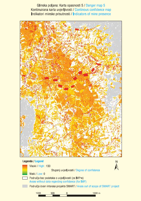
The Croatian Mine Action Centre (CROMAC) reviewed, defined and marked the entire mine suspected area (MSA) in Croatia by the year 2004. However, due to the need to reduce risk and the lack of information from the deepest reaches of the MSA, its surface area was defined as larger than in reality. Mine clearance is a long-term, expensive process, and Croatia has committed itself to resolving the problem of landmines on its territory by 201 9. Such developments have led to searching for and finding solutions to speed up resolution of the mine problem in Croatia (and in the world) through reducing the defined MSA. The reduction of an already defined MSA requires additional data and information from the deepest reaches of the MSA, on the basis of which a revision of existing SMEs to make reductions will be carried out. Based on these data and revision of the existing MSA, reduction can be performed. All subsequently collected data and information, together with previously known data from the CROMAC Mine Information System (MIS), are processed in the decision support system in conditions of uncertainty. The results obtained are displayed on different thematic maps, showing the positions of objects and their spatial impact on the environment. Thus, thematic maps allow insights into topics which experts in humanitarian demining can use to make decisions in the process. These thematic maps are the result of the methodology created within the project Space and Airborne Mined Area Reduction Tools (SMART), and further developed in the technological project System for Multisensor Airborne Reconnaissance and Surveillance in Emergency Situations and Environmental Protection, TP-06/0007-01 , Ministry of Science, Education and Sports; Deployment of Advanced Intelligence Decision Support System for Mine Suspected Area Reduction in Bosnia and Herzegovina and the author's doctoral dissertation. This paper establishes the new terminology for new, improved thematic maps that unambiguously define their content and facilitate communication between producers and users.
Keywords:thematic maps; humanitarian demining; indicators; zone of influence; weighting
Copyright (c) 2013 Andrija Krtalić

This work is licensed under a Creative Commons Attribution-ShareAlike 4.0 International License.