Spatial Quality of Manually Geocoded Multispectral and Multiresolution Mosaics
Abstract
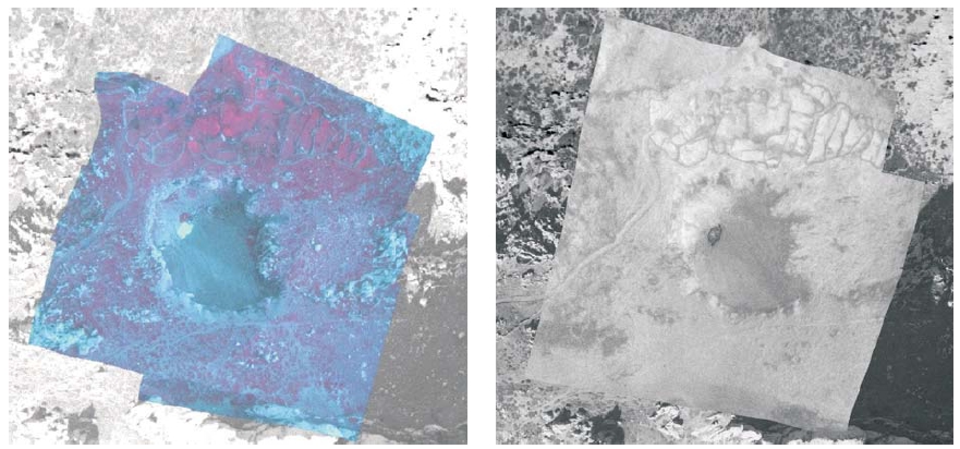
The digital airborne multisensor and multiresolution system for collection of information (images) about mine suspected area was created, within European commission project Airborne Minefield Area Reduction (ARC, EC IST-2000-25300, http://www.arc.vub.ac.be) to gain a better perspective in mine suspected areas (MSP) in the Republic of Croatia. The system consists of a matrix camera (visible and near infrared range of electromagnetic spectrum, 0.4-1.1 µm), thermal (thermal range of electromagnetic spectrum, 8-14 µm) and a hyperspectral linear scanner. Because of a specific purpose and seeking object on the scene, the flights for collecting the images took place at heights from 130 m to 900 m above the ground. The result of a small relative flight height and large MSPs was a large number of images which cover MSPs. Therefore, the need for merging images in largest parts, for a better perspective in whole MSPs and the interaction of detected object influences on the scene appeared. The mentioned system did not dispose of the module for automatic mosaicking and geocoding, so mosaicking and after that geocoding were done manually. This process made the classification of the scene (better distinguishing of objects on the scene) and fusion of multispectral and multiresolution images after that possible. Classification and image fusion can be even done by manually mosaicking and geocoding. This article demonstrated this claim.
Keywords
manual mosaicking; manual geocoding; geometric analysis; multisensor; multiresolution images
Copyright (c) 2008 Andrija Krtalić

This work is licensed under a Creative Commons Attribution-ShareAlike 4.0 International License.