Area Preserving Cartographic Line Generalizaton
Abstract
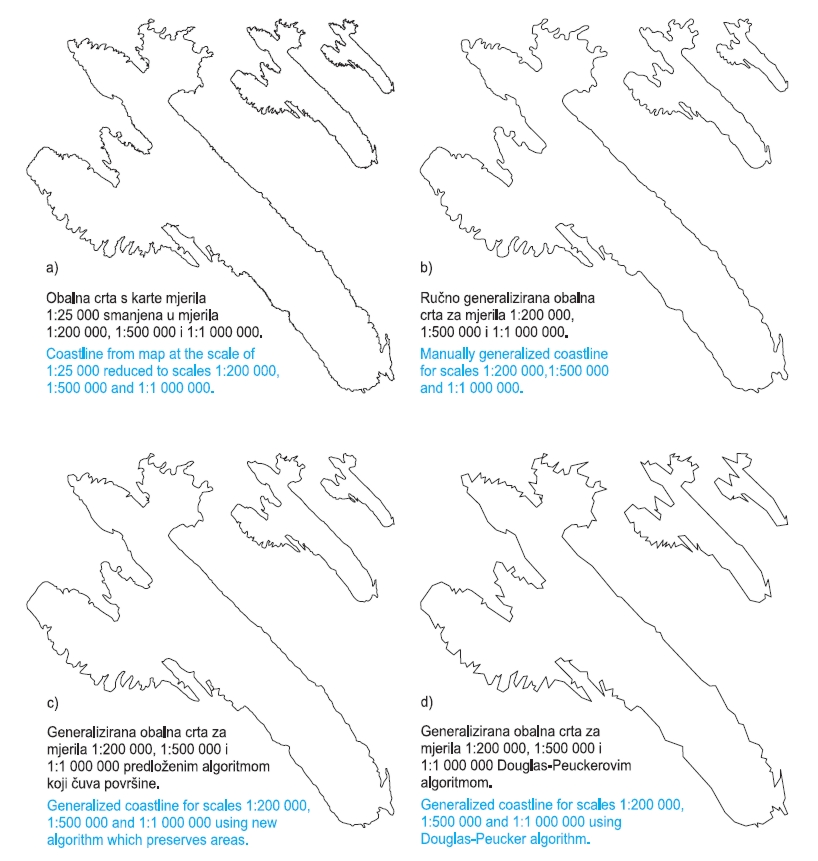
Cartographic line generalization is a generalization with the primary purpose of obtaining a line shape suitable for representation on maps at smaller scales than the scale of the given lines. Existing literature also differentiates model generalization and geographic generalization, each with a primary purpose. A new algorithm for cartographic generalization with distinct property of area preservation is described in this paper. The algorithm yields generalized lines with a subset of points from given lines together with new points. For that reason, it can be considered partially as simplification and partially as a smoothing process. Area preservation is not often considered in research on cartographic line generalization. Such research mostly stresses the importance of the line shape. A detailed description of the new algorithm is given in this paper, as well as the results of the application on coastlines. A comparison with manual line generalization, the Douglas-Peucker simplification algorithm, the Boyle smoothing algorithm and the combination of the latter two is also given. The tests show the new algorithm yields satisfactory results for cartographic line generalization. The property of area preservation is especially suitable for application in GIS when attributes are represented or analysed in regard to object areas.
Keywords
cartographic generalization; lines; area preservation
Copyright (c) 2013 Dražen Tutić, Miljenko Lapaine

This work is licensed under a Creative Commons Attribution-ShareAlike 4.0 International License.