Böttner’s Inventory and Other Finding Aids for the Grimani Maps Collection from the State Archive in Zadar
Abstract
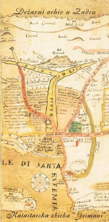
The paper briefly describes the development of cadastre in Dalmatia, with a special emphasis on the 18th century and the period of Governor Francesco Grimani’s rule. His Provision on Land Restructuring in Dalmatia from 1756 was appropriately named after him, the Grimani Law, just like the cadastre of this period was named the Grimani Cadastre and the integral cadastral plans the Grimani Maps. However, as time went by, the title Grimani Maps started being used for some 17th and 18th century cadastral plans, which did not originate from Francesco Grimani’s reform. Therefore, authors describe available archival finding aids from the State Archive in Zadar which may help in analysing cartographic material known as the Grimani Maps.
The oldest finding aid is Böttner’s handwritten inventory, which provides systematization for 800 maps, plans and drawings kept in the Archive. It has been paid special attention in this paper, even though it does not specifically mention the Grimani maps. However, it should be taken into consideration since it is still in use, despite being the oldest one. Appendix A contains basic information about E. Böttner’s life and work. Afterwards, the Tabularium journal, which was published in the period 1901–1904 is analysed in detail.
A review of archival material from the Zadar State Archive was published in its first issue. The material is associated with the present Grimani Maps Collection and paid considerable attention in this paper. It represents the first printed summarised inventory of the Zadar Archive. The entire content of all Tabularium issues is presented in Appendix B for the first time.
A description of internal inventory of the State Archive in Zadar follows and for the first time it presents a collection of cadastral maps titled Grimani Maps. The description is followed by an analysis of a Review of Archival Funds and Collections of the Republic of Croatia from 2006, as well as the latest network information system, ARHiNET.
Based on comparing the aforementioned finding aids, certain conclusions are drawn which should be helpful to future researchers. A provisional distinction of the Grimani Maps in broader as well as
in narrower sense is suggested until a better title for the collection is found. Furthermore, future research, as well as digitalisation of maps and finding aids is advised in order to preserve the original and facilitate data access.
Keywords
State Archive in Zadar; cadastre; Grimani Maps; Böttner; finding aids
Copyright (c) 2013 Lena Mirošević, Miljenko Lapaine

This work is licensed under a Creative Commons Attribution-ShareAlike 4.0 International License.