Developing Spatial Data Infrastructure in Croatia – Incorporating National and Regional Approach
Abstract
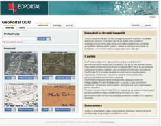
Although still not a member State of the European Union, Croatia has recognized in the spatial data infrastructure a concept that can significantly incite the modernization and effectiveness of the State administration, and create preconditions for the accelerated economic growth. Given this fact, Croatia has defined, after preparations which lasted several years, the legal framework for the national spatial data infrastructure establishment by adopting the Law on State Survey and Real Property Cadastre in 2007. During the adoption of this Law, great attention was paid to it being in line with the EU INSPIRE Directive (European Union, 2007) that was being adopted at the time, so the adopted provisions were fully compatible with the INSPIRE provisions. Regarding the model that Croatia has chosen in the establishment of its National Spatial Data Infrastructure (NSDI), the role of the State Geodetic Administration (SGA), the Croatian National Mapping and Cadastre Agency (NMCA), is significant. The SGA acts as a coordination body for the NSDI establishment, giving technical support to the NSDI bodies. One of the obligations is the establishment of a metadata catalogue through the national geoportal. Significant activities have been undertaken in the field of raising the awareness. The most important studies describing the manner of the NSDI establishment and current national as well as European situation have been translated into Croatian language and distributed to more than 1,000 NSDI stakeholders. Several workshops have been organised in order to transfer the best practices from the countries that have achieved big progress in this field.
In parallel with the national activities, Croatia, or rather the SGA, has recognized that the spatial data infrastructure (SDI) development cannot be based on isolated national activities connected exclusively to the INSPIRE Directive but that the Croatian spatial data infrastructure development activities must be part of the development of the regional and European spatial data infrastructure (ESDI). In this context, Croatia has recognized South-Eastern Europe as a region sharing many similarities, whether with regards to the historical legacy, development degree, current development directions, reform activities or the SDI development stage, although it should be pointed out that there are also differences. Given the above-mentioned similarities, Croatia has instigated the regional cooperation linked to the development of both national and regional SDI’s. Concrete achievements on this road are the establishment of the regional cooperation between cadastral organization, launching of the annual regional conference on the cadastre and preparation of the first regional SDI project entitled INSPIRATION – Spatial Data Infrastructure in the Western Balkans (Inspiration project). At the European level, the SGA is member of EuroGeographics, European organisation whose purpose is the improvement of the ESDI development, including topographic information, cadastre and land information. This paper describes the role and activities of the SGA in the SDI establishment at the national, regional and European level.
In parallel with the national activities, Croatia, or rather the SGA, has recognized that the spatial data infrastructure (SDI) development cannot be based on isolated national activities connected exclusively to the INSPIRE Directive but that the Croatian spatial data infrastructure development activities must be part of the development of the regional and European spatial data infrastructure (ESDI). In this context, Croatia has recognized South-Eastern Europe as a region sharing many similarities, whether with regards to the historical legacy, development degree, current development directions, reform activities or the SDI development stage, although it should be pointed out that there are also differences. Given the above-mentioned similarities, Croatia has instigated the regional cooperation linked to the development of both national and regional SDI’s. Concrete achievements on this road are the establishment of the regional cooperation between cadastral organization, launching of the annual regional conference on the cadastre and preparation of the first regional SDI project entitled INSPIRATION – Spatial Data Infrastructure in the Western Balkans (Inspiration project). At the European level, the SGA is member of EuroGeographics, European organisation whose purpose is the improvement of the ESDI development, including topographic information, cadastre and land information. This paper describes the role and activities of the SGA in the SDI establishment at the national, regional and European level.
Keywords
Spatial Data Infrastructure; INSPIRE; NSDI; regional SDI
Copyright (c) 2013 Željko Bačić, Ljerka Rašić, Miljenko Lapaine

This work is licensed under a Creative Commons Attribution-ShareAlike 4.0 International License.